Diferencia entre revisiones de «Galería:Tenerife»
De EnciclopediaGuanche
| Línea 13: | Línea 13: | ||
==[[Teide]] / [[Parque nacional del Teide]]== | ==[[Teide]] / [[Parque nacional del Teide]]== | ||
<gallery> | <gallery> | ||
| + | Image:ucanca2.jpg|Ucanca | ||
Image:Teide Tenerife.jpg|Teide volcano | Image:Teide Tenerife.jpg|Teide volcano | ||
Image:RoqueCinchado.jpg|Roque Cinchado, Teide | Image:RoqueCinchado.jpg|Roque Cinchado, Teide | ||
Revisión del 21:07 3 dic 2008
Heráldica
Space / Espacio / Espace
- TEIDE.JPG
Isla de Tenerife
Teide / Parque nacional del Teide
Municipalities / Municipios
Adeje
Arona
Candelaria
Garachico
Güímar
- Pyramiden Guimar2.JPG
Pyramids of Güímar
Granadilla de Abona
- Tenerife78.jpg
Costa de Montaña Roja
Icod de los Vinos
La Laguna
- La Laguna BW 7.JPG
Casa Alvarado Bracamonte, Patio
La Orotava
Puerto de la Cruz
- Playa Jardin Tenerife 2005.png
Playa Jardín, Puerto de la Cruz
See also Loro Parque
Los Realejos
Santa Cruz de Tenerife
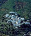
- SanAndrés1.JPG
San Andrés (a neighbourhood 7km from the centre)
- Anaga (Tenerife).jpg
Anaga
- Recinto ferial de Santa Cruz de Tenerife.jpg
Recinto ferial
Santiago del Teide
Vilaflor
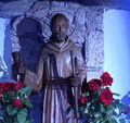
- Vilaflor BW 2.JPG
Denkmal Hermano Pedro
Masca
- 002-P1010043.JPG
Masca from a distance
- Teneriffa masca.JPG
Masca
- 026-P1010104.JPG
Masca - to lose sight of sth.
- 021-P1010062.JPG
Sky on Masca
- 027-P1010108.JPG
race is run, Masca
El Médano
Others / Otras
- Tenerife-phil3.jpg
- Tenerife-phil31.jpg
- Tenerife-phil5.jpg
- Tenerife0.jpg
- Tenerife2005 015.jpg
Igueste
Flora
Delta hurricane / Huracán Delta
Aeropuertos
Maps / Mapas
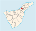
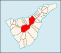
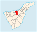
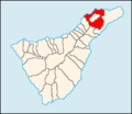
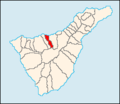
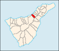
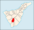
- TF Arafo.png
Map of Tenerife showing Arafo
- TF Arico.png
Map of Tenerife showing Arico
- TF Arona.png
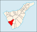
Map of Tenerife showing Arona
- TF BuenavistadelNorte.png
Map of Tenerife showing BuenavistadelNorte
- TF Candelaria.png
Map of Tenerife showing Candelaria
- TF Fasnia.png
Map of Tenerife showing Fasnia
- TF Garachico.png
Map of Tenerife showing Garachico
- TF Granadilla.png
Map of Tenerife showing Granadilla
- TF GuiadeIsora.png
Map of Tenerife showing Guía de Isora
- TF Guimar.png
Map of Tenerife showing Güímar
- TF PuertodelaCruz.png
Map of Tenerife showing Puerto de la Cruz
- TF ElRosario.png
Map of Tenerife showing El Rosario
- TF SanMiguel.png
Map of Tenerife showing San Miguel de Abona
- TF SantaCruzdeTF.png
Map of Tenerife showing Santa Cruz de Tenerife
- TF SantiagodelTeide.png
Map of Tenerife showing Santiago del Teide
- TF ElSauzal.png
Map of Tenerife showing El Sauzal
- TF LosSilos.png
Map of Tenerife showing Los Silos
- TF Tacoronte.png
Map of Tenerife showing Tacoronte
- TF ElTanque.png
Map of Tenerife showing El Tanque
- TF Tegueste.png
Map of Tenerife showing Tegueste
- TF LaVictoria.png
Map of Tenerife showing La Victoria
Formation / formación
- Teideform2.png
Cartoon of formation of Tenerife/Previous volcanic centres of the Island
- Teideformstage2.png
Stage Two: Las Cañadas central volcano
- Teideformstage3.png
Stage Three: Las Cañadas central volcano grows
- Teideformstage4.png
Stage Four: Las Cañadas central volcano colapses forming Las Cañadas caldera
